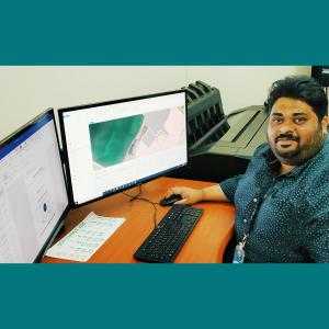
Jinu P.
GIS and Remote Sensing Professional and Cartographer
India | Asia/Kolkata (USD)
Full-time : 30+ hrs/week
ABOUT ME
I have more than 11 years of working experience in GIS and Remote Sensing, GPS, Lidar, Satellite and other land & air bound remotely sensed Image processing products, Geomatics, Geography, Survey, Big Data Science, AI, Computational Social Science, Application of statistical analysis, database management and data mining and collection, big data, network analysis, graph theory index calculations and analysis using Geomatics and GIS, Geo spatial visualizations, and web GIS development, Climate change etc. I have proven working knowledge and hands on experience in using, managing and administering complete infrastructure and databases related to all fields of GIS, Geometrics, Remote Sensing, Geospatial Lifecycle, Physical and Human Geography and geomorphology. I have thorough experience in managing and supporting complete GIS related IT domain and requirements. I am skilled in the development and application of Premier GIS Softwares of ESRI (ArcGIS 10.4.2, ArcPro, ArcGIS online and offline in local, Server and cloud based platforms and Arc Objects), MapInfo, Global mapper and other allied mapping systems like GPS and Lidar mapping; I have hands on Experience in open source GIS Programme like Google maps API, Q-GIS, FOSS GIS_OGC, Wikimapia, Mapbox, CartoDB, POSTGRESQL, etc. Additionally, I have deep skills in GIS data integration and processing, compiling, analyzing, and interpreting GIS and RS Databases. I also have working experience in Image processing softwares such as ERDAS & ENVI. I also have also handled multidisciplinary geospatial and programming based work on both open source and commercial geospatial technology over years. I Have been also working with implementing GIS with other relational platforms like GeoCRM, GeoECS, GeoCSM and also in integration GIS with SAP and allied business processing platforms as well as in integrating GIS with spatial archival systems. I am highly skilled in performing all kind of GIS analysis as well as Analytics such as Network, Spatial, Statistical, Surface, and Hydrological, Spectral etc. using both GIS and Image processing software’s. I also have knowledge of city government structure and process, principles of urban planning, city planning, land- Use mapping and Zoning. I have proven knowledge in almost all fields of geography and geomorphology and also have free hand design and graphic skills to prepare, plan and design topographic and utility maps. I am very excited to learn more about this opportunity and share how I will be a great fit for your requirements, looking at the excellent work opportunities you have been providing your employees in the past and at present I believe this is a position where my passion for this industry will further grow and provide the best in me benefiting both of us and the associated societies in general. If I am offered this position, I will be ready to hit the ground running and help you reach your complete expectations for success. I would appreciate the opportunity to meet with you to discuss further how my qualifications will be beneficial to your requirements and its success.